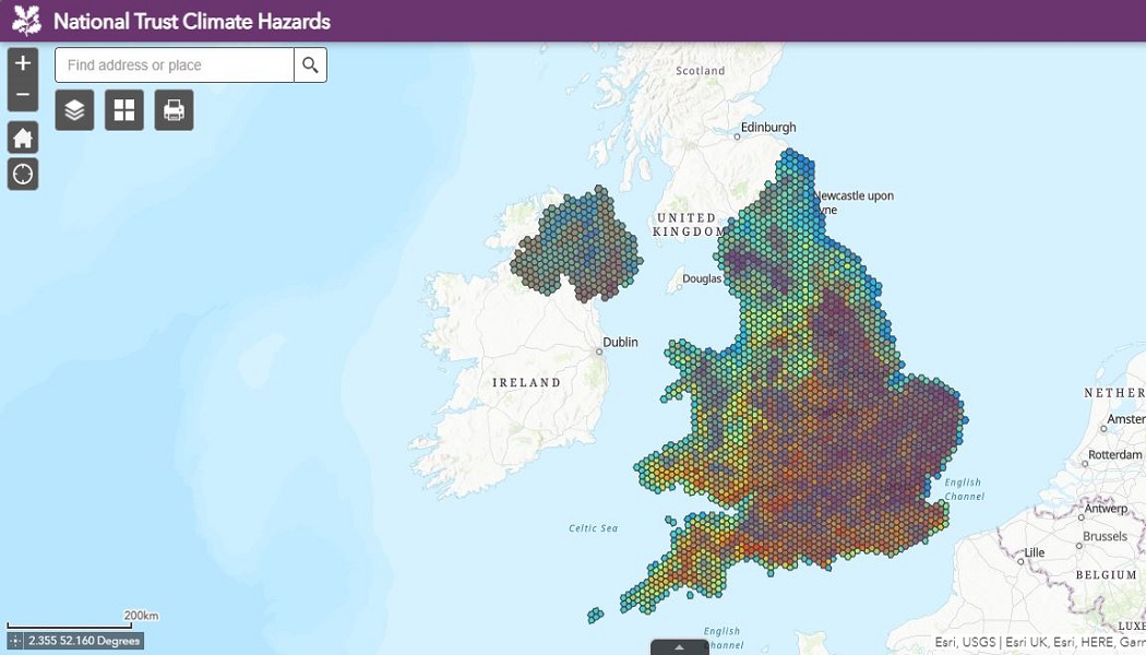
Never before has the potentially irreparable damage caused to heritage sites by climate change been laid bare for all to see. Now, courtesy of the National Trust Climate Hazards map, nobody will be able to say they weren’t warned about the cost of inaction.
The new resource, developed with sustainability consultancy 3Keel, plots data-driven projections of what could happen to British countryside locations, monuments, coastlines and historical sites over the next four decades.
Potential risk factors such as extreme heat and humidity, flooding, landslides, coastal erosion, soil heave, and high winds are all charted on a local scale in the years leading up to 2060.
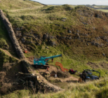
Using the map to inform its own planning, the Trust will identify areas at risk and implement interventions such as tree planting to slow water run-off or peat bog restoration to hold back water.
National Trust to plant 20 million trees in pursuit of ‘net zero’ by 2030
Worst case scenario
The Climate Hazards map projects the environmental outcomes if no interventions on emissions are made before 2060. This, its forecasts outline, would mean:
- The number of National Trust sites at high or medium risk of climate related hazards could increase from 30% (20,457) in 2020 to 71% (47,888) in 2060, with the those in the highest threat level accounting for 17%
- Heat and humidity rise will see a third of National Trust sites in the South East of England experience at least 15 days a year with temperatures over 30°C, with this exacerbated in urban areas like London due to the Urban Heat Island effect
- Storm damage, landslides and flooding will become increasingly common occurrences and more widespread, particularly in Wales and the North of England
- Coastal erosion and flooding will increase in Northern Ireland, potentially leading to more landslides around locations like the Giant’s Causeway
“This map is a game changer in how we face the threat climate change poses to the places we care for. While the data draws on a worst-case scenario, the map paints a stark picture of what we have to prepare for,” notes Harry Bowell, National Trust’s director for land and nature.
“But by acting now, and working with nature, we can adapt to many of these risks. One of the most exciting opportunities here is the map ensures a joined-up approach in which neighbours, landowners, charities and developers can come together to identify risks and collectively intervene to tackle issues and make large scale change.”
While the charity will increasingly use the map to guide its work in the natural world, it is hoped government bodies in England, Wales, Northern Ireland and Scotland will all utilise the tool to assess the risks facing heritage locations they care for and develop a suitable response for their protection.
“Government can play its part by strengthening its environment bill investing in green infrastructure, growing the sectors, jobs and industries that will enable us to tackle and adapt to the impacts of climate change before world leaders come together at COP26 in November,” Bowell adds.
While no government has yet signalled concrete intent to use the map to steer decision making, praise has been roundly heaped on the Trust for this latest initiative.
A spokesperson for the independent Climate Change Committee said the tool represents a “pioneering approach” which would be used to support its “research and analysis into the vulnerability and exposure of some of the nation’s most important and sensitive heritage sites to future climate change”.
Duncan Wilson, chief executive of Historic England, has also shared his enthusiasm for the project, noting that he is “excited to be working with them [National Trust and 3Keel] and our colleagues around the UK to develop this approach further, so that we can understand the hazards faced by all our heritage”.